
What Is Spatial Computing?
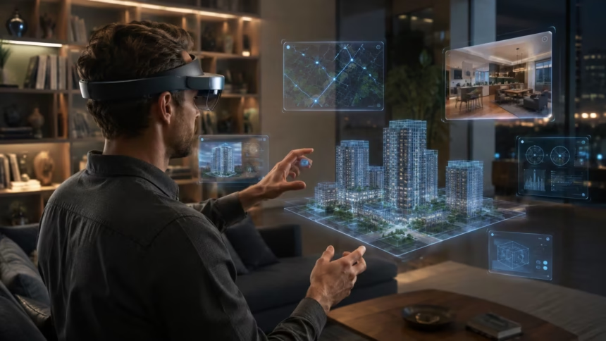
Spatial computing is a way of using digital technology that understands and responds to the physical space around a person. Instead of keeping apps, information and controls inside a flat screen, it places digital objects within a three-dimensional environment. People can then interact with those objects through natural movements such as looking, pointing, speaking or moving their hands.
The technology combines elements of augmented reality, virtual reality, mixed reality, computer vision and artificial intelligence. Cameras and sensors observe the surrounding environment, while software calculates the position of walls, furniture, people and objects. A spatial computing device then uses this information to make digital content appear connected to the real world.
Imagine placing a virtual television on a bedroom wall, viewing a life-sized engine in a workshop or examining a three-dimensional model of the human heart from every angle. The digital object can remain in a specific position as the user moves around it. This sense of stability makes the experience feel more like interacting with a physical object than viewing an image.
Spatial computing is still developing, but it is moving beyond gaming and entertainment. Businesses use it for product design, training, remote collaboration and equipment maintenance, while healthcare and education organizations are exploring immersive learning experiences. Understanding how spatial computing works reveals why it could become an important part of everyday digital interaction.
What Is Spatial Computing in Simple Terms?
Spatial computing allows computers to understand the shape, location and movement of objects in the physical world. It gives digital systems a sense of space, distance and direction rather than treating every interaction as something that happens on a two-dimensional display. This spatial awareness allows software to respond appropriately to the user’s surroundings.
In a traditional computing experience, a person controls information through a monitor, mouse, keyboard or touchscreen. Spatial computing expands that relationship by placing digital information around the user. A virtual calendar may appear on a wall, several work windows may float above a desk or a digital character may walk across the actual floor.
The system must understand where the user is standing and how their head, hands and eyes are moving. It also needs to recognize nearby surfaces and obstacles so digital objects can behave realistically. For example, a virtual ball should bounce on the floor instead of passing through it or disappearing behind the wrong piece of furniture.
Spatial computing is not one device or product category. It is a broader computing approach that can appear in headsets, augmented reality glasses, smartphones, tablets, vehicles and robots. Any system that understands physical space and connects digital actions to that space can use spatial computing principles.
How Does Spatial Computing Work?
Spatial computing begins by gathering information about the user and the surrounding environment. Cameras, depth sensors, motion sensors and microphones continuously collect visual, positional and audio data. The device processes these signals to determine where the user is, what objects are nearby and how the environment is changing.
The system then creates a three-dimensional model of the space. This digital representation may include walls, floors, ceilings, furniture and open walking areas. It can also identify meaningful objects such as a table, computer, keyboard or human hand, depending on the capabilities of the device and software.
After understanding the environment, the system places digital content into it. Real-time rendering software adjusts the object’s size, lighting, perspective and position according to the user’s viewpoint. When the person turns their head or walks closer, the content changes naturally, creating the impression that it occupies a stable physical location.
Interaction software connects the user’s actions with the virtual content. Looking at a button may highlight it, pinching two fingers may select it and speaking a command may open an app. These stages happen continuously and with very little delay so the experience feels responsive, comfortable and believable.
The Core Technologies Behind Spatial Computing
Spatial computing relies on a combination of hardware and software rather than one single invention. Cameras capture visual information, depth sensors measure the distance between surfaces and inertial sensors track the movement of the device. Together, these components provide the raw information needed to understand physical space.
Computer vision software interprets what the sensors observe. It can detect surfaces, recognize objects, follow hand movements and estimate the user’s position. Machine-learning models improve this process by identifying patterns that would be difficult to describe through fixed programming rules alone.
Real-time graphics engines generate the digital objects displayed to the user. They calculate perspective, shadows, reflections, textures and movement many times each second. High-performance processors are required because delays or visual errors can break immersion and may cause discomfort during extended use.
Spatial computing also depends on connectivity, operating systems, application frameworks and open development standards. These technologies allow apps to communicate with sensors, save spatial information and run across compatible devices. The complete experience emerges when all these components work together as one coordinated computing system.
Spatial Mapping Helps Devices Understand a Room
Spatial mapping is the process of creating a digital representation of the surrounding environment. A device may scan the room and identify major surfaces such as the floor, walls, ceiling, tables and doors. This map helps the software understand where digital content can be placed safely and realistically.
Depth cameras and lidar sensors can measure how far objects are from the device. They generate thousands or millions of spatial points that outline the environment. Software combines these points into surfaces or meshes, producing a three-dimensional structure that can be used by applications.
Once the map has been created, digital objects can interact with physical surfaces. A virtual lamp can sit on a real table, an animated character can hide behind a sofa and a digital screen can remain attached to a wall. These interactions make spatial experiences feel integrated rather than simply layered over a camera image.
Spatial maps may update as objects move or the user enters a different area. Advanced systems can remember selected locations between sessions through persistent spatial anchors. This means a digital clock placed on a wall could appear in the same position the next time the user enters the room.
Tracking Keeps Digital Content in the Right Place
Tracking allows a spatial computing device to understand movement and orientation. Head tracking detects where the user is looking, while hand tracking follows fingers, palms and gestures. Eye tracking can estimate the exact part of the interface receiving the user’s attention.
A technique called simultaneous localization and mapping helps the device build a map while determining its own position within that map. The system compares visual features from one moment to the next and estimates how far the device has moved. Motion sensors provide additional information about speed, direction and rotation.
Accurate tracking is essential because even a small positioning error can make digital content appear unstable. A virtual screen should remain attached to its chosen location when the user turns away and looks back. If it shakes, drifts or slides across the wall, the experience immediately feels less convincing.
Tracking must also work in changing lighting and across different room layouts. Blank walls, reflective surfaces, darkness and rapid movement can make the task more difficult. Developers combine multiple sensor types and predictive software to maintain stable tracking when one source of information becomes temporarily unreliable.
Computer Vision Gives Machines Spatial Awareness
Computer vision allows a device to extract useful meaning from images and video. Instead of seeing only coloured pixels, the system attempts to recognize surfaces, objects, people and movement. This ability forms a major part of the spatial awareness required for mixed reality experiences.
A spatial computing system may use computer vision to identify a user’s hands without requiring physical controllers. It can locate each finger, estimate the shape of the hand and interpret gestures. Similar techniques help the device recognize furniture, doors, tools, faces and other features of the environment.
Scene understanding goes beyond detecting individual objects. It examines how those objects relate to one another and what role they play within the space. The system may determine that a flat horizontal surface is a desk, that a chair is positioned beside it and that the open area between them can be used for walking.
Reliable scene understanding helps digital content behave more intelligently. An application can avoid placing a menu inside a wall or direct a virtual character around physical furniture. As visual AI improves, spatial systems may become better at understanding the purpose and context of everyday environments.
Artificial Intelligence Makes Spatial Experiences Smarter
Artificial intelligence helps spatial computing systems recognize patterns, interpret natural language and respond to changing environments. Machine-learning models can process information from cameras, microphones and motion sensors simultaneously. This allows the device to understand not only what the user says but what they are looking at and doing.
A multimodal AI assistant could identify an object in the room, answer a question about it and display instructions beside it. Someone repairing a machine might ask which component should be removed next, while the system highlights the correct part. This creates a more contextual form of computing than a standard text-based assistant.
Generative AI can also help create three-dimensional models, textures, environments and animations. Designers may describe an idea in natural language and receive a basic spatial scene that they can refine. This can lower the technical barrier to producing immersive content and speed up early design work.
AI does not make spatial systems perfectly intelligent or reliable. Visual models can misidentify objects, misunderstand gestures or respond incorrectly to ambiguous instructions. Important applications still require safety controls, human oversight and careful testing before AI-generated guidance can be trusted.
Displays and Optics Create the Visual Experience
Spatial computing devices need a way to present digital images while preserving a convincing sense of depth. Headsets may use small high-resolution displays positioned close to the eyes, while augmented reality glasses can project light through transparent lenses. Each approach creates different advantages and technical challenges.
Virtual reality devices usually block the direct view of the physical environment and display a computer-generated world. Mixed reality headsets may use outward-facing cameras to show a live view of the room on internal displays. Digital objects are then added to this video view through a method commonly called passthrough.
Optical see-through glasses allow users to view the real world directly through transparent material. Digital information is projected into the wearer’s field of view without replacing the natural scene. These devices can feel less isolating, but achieving a wide field of view, high brightness and realistic depth remains difficult.
The display must update quickly as the user moves. If the visual scene responds too slowly to head movement, the experience may feel unstable and cause nausea or eye strain. Low latency, accurate tracking and consistent frame rates are therefore essential parts of comfortable immersive computing.
Hand, Eye and Voice Controls Replace Traditional Inputs
Spatial interfaces are designed to feel more natural than traditional menus controlled by a mouse. Hand tracking allows users to point, grab, rotate and resize digital content. Small gestures can also select buttons or scroll through information without requiring a physical controller.
Eye tracking can identify the object receiving the user’s attention. The system may highlight an interface element when the person looks at it and wait for a hand gesture to confirm the selection. This combination reduces the amount of arm movement required and can make navigation faster.
Voice control provides another useful input method. Users can open apps, search for information, dictate text or move through menus by speaking. Voice is especially valuable when the user’s hands are occupied with a physical task or when a complex command would be difficult to communicate through gestures.
Effective spatial interfaces usually combine several inputs rather than depending on one method. A person may look at an object, pinch to select it and speak to request additional information. This multimodal interaction allows the user to choose the most convenient method for each situation.
Spatial Audio Makes Digital Content Feel Present
Spatial audio creates the impression that sound is coming from a specific position in three-dimensional space. A virtual person standing to the left should sound as though their voice is coming from that direction. When the user turns their head, the apparent source of the sound should remain stable.
The system uses information about head position, distance and room characteristics to adjust the audio reaching each ear. Differences in timing and volume help the brain estimate where the sound is located. Reflections and echoes can also be simulated to make the audio match the surrounding environment.
Spatial sound can improve navigation and awareness. An application may use audio cues to guide a user toward an object that is outside their current field of view. In training simulations, the direction of a warning sound can help a worker recognize where a hazard is developing.
Audio is also important for social presence. In a virtual meeting, voices can appear to come from the position of each participant rather than from one central speaker. This separation may make conversations easier to follow and create a stronger feeling of sharing the same space.
Spatial Computing vs AR, VR, MR and XR
Augmented reality adds digital information to a view of the physical world. A smartphone app that places a virtual piece of furniture inside a camera image is a familiar example. The user remains aware of the real environment while viewing an added digital layer.
Virtual reality replaces the visible physical environment with a computer-generated one. A VR headset can transport the user into a game, simulated workplace or virtual classroom. The experience may be highly immersive, but the person is usually less aware of nearby physical objects.
Mixed reality allows digital and physical elements to interact more deeply. Virtual objects can respond to walls, furniture and the user’s hands instead of simply floating over a video image. The phrase extended reality, or XR, is commonly used as an umbrella term covering AR, VR and mixed reality.
Spatial computing is broader than any one of these display formats. It describes the ability of computers to understand space and make digital interactions spatially meaningful. AR, VR and MR devices are common ways to experience spatial computing, but robots, vehicles and other environment-aware systems can also use it.
Spatial Computing Devices and Platforms in 2026
The spatial computing market now includes several hardware and software ecosystems. Apple Vision Pro uses visionOS to place applications, media and interactive content throughout the user’s surroundings. Its interface relies heavily on eye tracking, hand gestures and voice rather than traditional handheld controllers.
Meta’s Quest devices combine virtual reality with full-colour mixed reality passthrough. Their spatial features include hand tracking, room understanding and persistent digital content. These devices have helped bring mixed reality applications to a broader consumer audience, particularly in gaming, fitness and entertainment.
Samsung Galaxy XR introduced another major spatial platform built on Android XR, developed with Google and Qualcomm. The platform connects familiar Android apps with immersive interfaces, multimodal AI and open development technologies. It is designed to support different device types, including headsets and future smart glasses.
These platforms demonstrate that spatial computing is becoming an ecosystem rather than a single product. Developers can now build for several operating systems and hardware categories, although differences in sensors and interfaces remain. Open standards are increasingly important for reducing the cost of adapting each experience.
Spatial Computing in Business and Industry
Businesses can use spatial computing to visualize information that is difficult to understand on a flat screen. Architects may walk through a proposed building before construction begins, while product designers can inspect a life-sized model from multiple angles. Changes can be reviewed before expensive physical prototypes are produced.
Manufacturers can provide workers with step-by-step instructions positioned directly beside machinery. The system may highlight a component, display safety information and confirm whether each task has been completed. This can reduce dependence on printed manuals and make complicated procedures easier to follow.
Remote experts can also support workers through a shared spatial view. A technician in one location may stream what they see while a specialist adds arrows, diagrams or instructions to the environment. This approach can reduce travel and provide faster access to specialized knowledge.
Companies are also exploring spatial workspaces for presentations, data analysis and collaboration. Multiple virtual screens can be arranged around the user without requiring several physical monitors. The long-term value will depend on comfort, software quality, security and whether the experience genuinely improves productivity.
Healthcare Uses of Spatial Computing
Medical students can use spatial computing to explore detailed three-dimensional models of organs and body systems. Instead of memorizing anatomy from a flat illustration, they can move around a structure and view how different parts connect. This can make complex spatial relationships easier to understand.
Surgeons may use immersive tools for procedure planning and medical-image visualization. Information from scans can be converted into a three-dimensional model that helps the clinical team examine an individual patient’s anatomy. These systems are intended to support professional judgement rather than replace it.
Rehabilitation programmes can create interactive exercises that encourage movement, balance and coordination. A patient may reach for virtual objects, practise daily tasks or receive immediate feedback on their performance. The activity can be adjusted according to ability and progress under professional supervision.
Healthcare applications require strong evidence, privacy protections and appropriate regulatory approval. A visually impressive experience is not automatically medically effective. Systems used for diagnosis, treatment or clinical decision-making must be tested carefully to confirm that they are safe and genuinely useful.
Spatial Computing in Education and Training
Spatial learning can help students interact with subjects that are difficult to observe directly. They might examine a molecule, explore an ancient building or travel through a model of the solar system. The ability to change scale and viewpoint can make abstract concepts feel more understandable.
Training simulations allow learners to practise tasks without creating the risks or expenses of a real environment. Pilots, technicians, emergency responders and industrial workers can repeat difficult scenarios while receiving structured feedback. Mistakes become learning opportunities rather than immediate threats to equipment or safety.
The technology can also support collaborative learning. Students in different locations may enter the same digital space, examine shared objects and discuss their observations. Spatial audio and avatars can strengthen the feeling of working together compared with an ordinary video call.
Immersion alone does not guarantee better learning. The experience must support a clear educational goal and avoid unnecessary distraction. Schools also need to consider device costs, accessibility, teacher preparation, privacy and the amount of time students spend wearing head-mounted displays.
Retail, Design and Real Estate Applications
Spatial computing can help shoppers understand how products will look and fit before purchasing them. A customer may place a life-sized sofa in a living room, test different paint colours or inspect a three-dimensional model of a product. This can reduce uncertainty when buying large or highly visual items.
Retailers can create interactive showrooms without displaying every physical variation. Customers may change colours, materials and features while viewing the product at realistic scale. The experience can be offered through a headset, smartphone or augmented reality display depending on the situation.
Interior designers and architects can present plans as spaces that clients can walk through. This makes it easier to identify layout problems, compare design options and understand proportions. Decisions that are difficult to make from drawings may become clearer when experienced at human scale.
Real estate professionals can use immersive tours to show properties remotely. Buyers may explore rooms, inspect layouts and compare homes without travelling to each location. Virtual tours cannot reveal every physical detail, but they can make the early stages of property selection more efficient.
Digital Twins Connect Spatial Computing With Real Systems
A digital twin is a virtual representation of a physical object, building, production line or other system. It may receive live information from sensors so that its digital state reflects changes in the real environment. Spatial computing provides a natural way to view and interact with this information.
An engineer could examine a three-dimensional model of a factory and see which machines are operating normally. Temperature, vibration and maintenance information may appear beside each piece of equipment. Problems can be identified without searching through several separate dashboards.
Digital twins can also support planning and simulation. A company may test changes to a warehouse layout before moving physical equipment. Traffic flow, worker movement and machine placement can be evaluated in a virtual model, reducing the risk of expensive mistakes.
The quality of a digital twin depends on accurate data and regular updates. An outdated model can create misleading conclusions, regardless of how realistic it appears. Organizations therefore need reliable sensors, data governance and clear processes for maintaining the connection between the digital and physical systems.
Benefits of Spatial Computing
One of the main benefits of spatial computing is improved understanding of three-dimensional information. Certain ideas are easier to grasp when people can see their true scale, position and relationship to other objects. This can support learning, design, planning and technical decision-making.
Spatial technology can also place information where it is needed. Instead of looking away from a task to read instructions, a worker may see guidance beside the relevant component. This contextual delivery can reduce mental effort and make complicated workflows easier to follow.
Remote collaboration may become more practical when participants can share models and environments. Teams can review the same product design, point to specific details and make changes together. The experience may provide a stronger sense of presence than exchanging screenshots or discussing a model through video.
Spatial computing may also improve accessibility for some users. Voice commands, eye tracking and gesture controls can provide alternatives to keyboards and touchscreens. However, accessibility varies considerably, and developers must design for different visual, hearing, mobility and cognitive needs from the beginning.
Limitations and Challenges of Spatial Computing
Current spatial devices can be expensive, heavy or uncomfortable during extended sessions. Pressure on the face, heat, limited battery life and the need to adjust the headset can interrupt the experience. Reducing device size without sacrificing performance remains a major engineering challenge.
Motion sickness and visual discomfort can also affect some users. Delayed tracking, low frame rates or a mismatch between visible movement and physical sensation may cause nausea or dizziness. Even well-designed systems may require gradual use and regular breaks.
The technology can struggle in darkness, bright sunlight or visually complex environments. Reflective surfaces and moving objects may reduce mapping accuracy, while hand tracking can fail when gestures are hidden. Developers need fallback controls and clear signals when the system is uncertain.
Content availability remains another limitation. A headset becomes valuable only when it supports useful applications that justify its cost and inconvenience. Building high-quality spatial experiences requires specialized design, three-dimensional assets, testing and performance optimization across multiple devices.
Privacy and Safety Concerns
Spatial computing devices can collect unusually detailed information about users and their surroundings. Cameras may observe the layout of a home, while eye tracking can reveal what attracts a person’s attention. Hand movements, voice recordings and body position may also become part of the system’s data.
This information can be useful for interaction, but it also creates privacy risks. Companies need clear rules explaining what is processed on the device, what is uploaded and how long it is stored. Users should have meaningful control over access to cameras, microphones and spatial maps.
Physical safety is another concern. A user who is focused on digital content may fail to notice stairs, furniture, pets or other people. Boundary systems, object detection and transparent views of the room can reduce the risk, but they cannot replace personal awareness.
Social safety matters as well. Recording indicators should be easy for nearby people to understand, and users should respect restrictions in private or sensitive environments. Responsible spatial computing requires protecting both the person wearing the device and everyone who may appear in its sensors.
Open Standards and Spatial App Development
Developers create spatial applications using tools for three-dimensional graphics, interface design, physics, tracking and environmental understanding. Popular development approaches include native platform frameworks, real-time engines and browser-based immersive technologies. The best choice depends on the device and the complexity of the experience.
OpenXR provides a common programming interface for building applications across supported augmented and virtual reality hardware. It can reduce the amount of platform-specific work required to support different headsets. This portability is valuable as the spatial computing market expands across several ecosystems.
Newer spatial standards are also addressing plane detection, markers, anchors and persistent content. These capabilities allow applications to understand physical surfaces and remember digital positions between sessions. Standardization can make it easier for developers to create consistent experiences across compatible platforms.
Differences between devices will not disappear completely. Eye tracking, controller designs, display quality and sensor configurations can vary significantly. Developers must still test each platform carefully and adapt interfaces so they remain comfortable, accessible and intuitive for the intended audience.
The Future of Spatial Computing
Spatial computing devices are likely to become lighter, more efficient and easier to wear. Improvements in displays, batteries, sensors and optical systems may gradually reduce the difference between bulky headsets and ordinary glasses. Progress will probably happen through several device categories rather than one universal form.
Artificial intelligence will make spatial systems more aware of context. Future assistants may understand what the user is viewing, remember selected locations and provide information at the appropriate moment. This could make computing feel more connected to real tasks instead of requiring people to search through separate apps.
Shared spatial experiences may also improve. People in different locations could collaborate around the same three-dimensional object while preserving eye contact, gestures and positional audio. More realistic representations may strengthen remote work, education and social interaction, although privacy and authenticity concerns will remain.
Spatial computing is unlikely to replace phones, laptops and physical screens immediately. It will first become valuable in situations where understanding space provides a clear advantage. Its success will depend on whether devices become comfortable, affordable, trustworthy and useful enough to fit naturally into everyday life.
Final Thoughts on Spatial Computing
Spatial computing allows digital systems to understand and interact with the physical environment. It combines sensors, computer vision, artificial intelligence, real-time graphics and natural controls to place digital content within three-dimensional space. The result is a more environment-aware approach to human-computer interaction.
The technology includes augmented reality, virtual reality and mixed reality but extends beyond them. Its defining feature is not simply wearing a headset or seeing a virtual object. It is the computer’s ability to understand location, scale, movement and relationships within a physical or digitally created environment.
Current applications include training, healthcare, manufacturing, design, education, entertainment and remote collaboration. These uses can make information more visual and contextual, but they must provide practical advantages over existing tools. Immersion should support the task rather than become a distraction.
Spatial computing is still an emerging field, and important challenges remain around comfort, privacy, cost, safety and software quality. As devices and open standards improve, spatial interfaces may become a more familiar part of computing. The transition will be gradual, but it could reshape how people experience digital information.
Frequently Asked Questions
What is an example of spatial computing?
Placing a life-sized virtual sofa inside your real living room is one example. The device measures the room, positions the model on the floor and keeps it stable as you move around it.
Is spatial computing the same as virtual reality?
No. Virtual reality replaces the visible environment with a digital world, while spatial computing is a broader concept involving computers that understand and respond to three-dimensional space.
What devices use spatial computing?
Spatial computing can be used by mixed reality headsets, augmented reality glasses, smartphones, tablets, robots and vehicles. Apple Vision Pro, Galaxy XR and Meta Quest devices are notable headset examples.
Does spatial computing require artificial intelligence?
Not every spatial feature requires AI, but modern systems commonly use it for object recognition, hand tracking, scene understanding and voice interaction. AI can make spatial experiences more contextual and responsive.
What is spatial computing used for?
It is used for immersive entertainment, employee training, product design, medical visualization, education, remote assistance, digital twins and three-dimensional workplace collaboration.